Storm Francis Follows Hot on the Heels of Ellen

At the moment I’m too busy writing about the seemingly never ending sequence of power cuts due to “extreme weather” events to wax lyrical about developments in vehicle-to-grid technology!

In California the heat wave is over and rolling blackouts a thing of the past, for the moment at least. However the wildfires continue, and the Lawrence Berkeley
National Laboratory is temporarily closed:

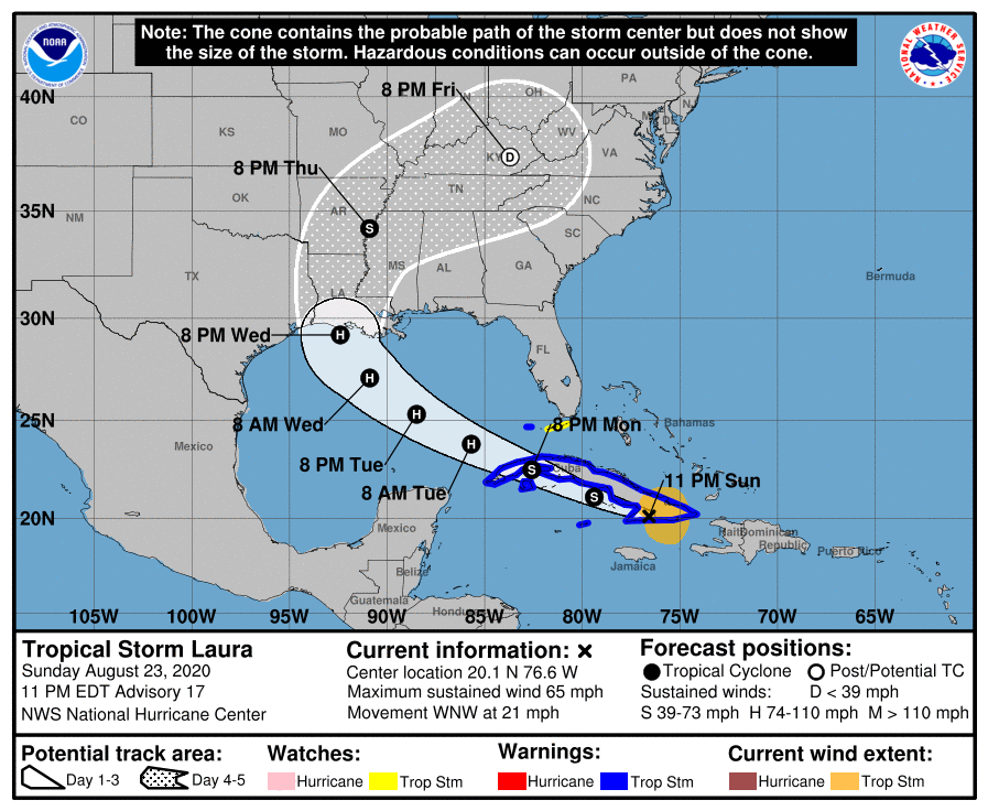
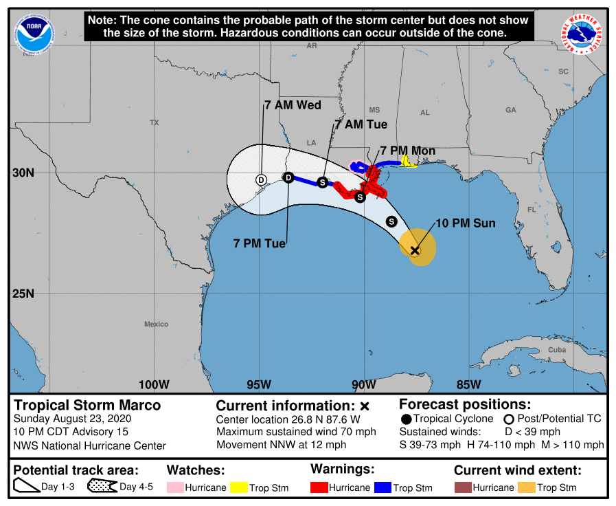
Meanwhile in the Gulf of Mexico tropical storms Laura and Marco are simultaneously heading for the Louisiana coast. Laura is forecast to be a hurricane by the time she gets there, with Marco being merely an ex hurricane by landfall later today.

Now this morning comes news that hot on the heels of Storm Ellen last week, which caused many tens of thousands of properties in Ireland to suffer a power cut, the United Kingdom’s Meteorological Office has named Storm Francis:

Further power cuts are expected in the near future, on the shores of both the Gulf of Mexico and the North Atlantic! Here is the local wind forecast for the V2G Group office in (Silic)Inny Valley, North Cornwall, courtesy of MeteoCiel:

Please note that this forecast is for the peak of the post 2020 Covid-19 lockdown Cornish staycation season, not the middle of winter!


[Edit – August 25th 08:00]

As the winds from Storm Francis increase over South West England let’s take a quick look at current and projected electricity generation for today:

Plus today’s Octopus Energy Agile electricity tariff for South West England:

and the United Kingdom’s carbon intensity forecast:

[Edit – August 25th 22:00]

Here’s an image of Storm Francis over the British Isles recorded earlier today by the Suomi satellite:

Marco and Laura Gang Up On Gulf Coast

Only last week we were following power cuts caused by both a heat wave in California and hurricane force winds in Ireland thanks to the extratropical cyclone dubbed Storm Ellen by Met Éireann. This week we already have two hurricanes heading for the United States coast in the Gulf of Mexico, where a significant storm surge and numerous power outages are now expected.

The sustained wind speeds of Hurricane Marco have just dropped below the Saffir-Simpson scale category 1 threshold of 74 miles per hour. However storm surge and hurricane warnings are still in place for the Gulf coast of Lousiana:

A STORM SURGE WARNING IS IN EFFECT FOR.... 
* MORGAN CITY LOUISIANA TO OCEAN SPRINGS MISSISSIPPI
* LAKE BORGNE
A HURRICANE WARNING IS IN EFFECT FOR...
* MORGAN CITY LOUISIANA TO THE MOUTH OF THE PEARL RIVER

Marco is due to make landfall later this evening. Meanwhile Tropical Storm Laura, currently crossing Cuba, is forecast to strengthen as she crosses the Gulf before making landfall at hurricane strength on Wednesday night, in Louisiana once again:

FORECAST VALID 27/0000Z 29.2N  92.4W
MAX WIND 90 KT...GUSTS 110 KT.
50 KT... 50NE 40SE 30SW 40NW.
34 KT...100NE 100SE 50SW 80NW.

Significant damage to the electricity distribution infrastructure in the southern USA is expected. Yet again we are compelled to wonder if many of the anticipated power outages could have been prevented if areas of the United States vulnerable to hurricane damage already possed significant numbers of vehicle-to-grid capable electric vehicles and bidirectional charging stations?

Continue reading →