Hurricane Sally Heads for Louisiana

Louisiana still hasn’t recovered from the damage caused by the passage of Hurricane Laura last month. Here’s how the state’s power outage map looks this morning (UTC):

Now yet another storm is heading for the coast of the Gulf of Mexico. Tropical Storm Sally is forecast to increase in strength to hurricane force before crossing the coast further to the east than Laura:

According to the National Hurricane Center:

CENTER LOCATED NEAR 28.2N  86.2W AT 14/0300Z
ESTIMATED MINIMUM CENTRAL PRESSURE  996 MB
MAX SUSTAINED WINDS  50 KT WITH GUSTS TO  60 KT.

FORECAST VALID 14/1200Z 28.6N  87.3W
MAX WIND  60 KT...GUSTS  75 KT.

FORECAST VALID 15/0000Z 29.0N  88.3W
MAX WIND  70 KT...GUSTS  85 KT.

FORECAST VALID 15/1200Z 29.4N  89.0W
MAX WIND  80 KT...GUSTS 100 KT.

FORECAST VALID 16/0000Z 30.3N  89.4W...INLAND
MAX WIND  70 KT...GUSTS  85 KT.

[Edit – September 16th 10:00]

Hurricane Sally is currently making landfall further east than originally forecast:

Here’s the NHC’s current forecast track for Sally:

and their latest estimate of Sally’s strength:

NOAA buoy 42012, located about 50 miles southeast of Mobile, 
Alabama, recently reported a sustained wind of 71 mph (115 km/h) and 
a pressure of 970.9 mb inside the eastern portion of Sally's eye.

SUMMARY OF 300 AM CDT...0800 UTC...INFORMATION
----------------------------------------------
LOCATION...30.0N 87.8W
ABOUT 50 MI...75 KM SW OF PENSACOLA FLORIDA
ABOUT 55 MI...85 KM SE OF MOBILE ALABAMA
MAXIMUM SUSTAINED WINDS...105 MPH...165 KM/H
PRESENT MOVEMENT...NNE OR 020 DEGREES AT 3 MPH...5 KM/H
MINIMUM CENTRAL PRESSURE...965 MB...28.50 INCHES

So far Alabama has suffered the most, with almost 200,000 power cuts currently.

Marco and Laura Gang Up On Gulf Coast

Only last week we were following power cuts caused by both a heat wave in California and hurricane force winds in Ireland thanks to the extratropical cyclone dubbed Storm Ellen by Met Éireann. This week we already have two hurricanes heading for the United States coast in the Gulf of Mexico, where a significant storm surge and numerous power outages are now expected.

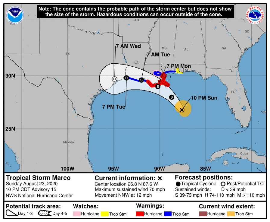
The sustained wind speeds of Hurricane Marco have just dropped below the Saffir-Simpson scale category 1 threshold of 74 miles per hour. However storm surge and hurricane warnings are still in place for the Gulf coast of Lousiana:

A STORM SURGE WARNING IS IN EFFECT FOR.... 
* MORGAN CITY LOUISIANA TO OCEAN SPRINGS MISSISSIPPI
* LAKE BORGNE
A HURRICANE WARNING IS IN EFFECT FOR...
* MORGAN CITY LOUISIANA TO THE MOUTH OF THE PEARL RIVER

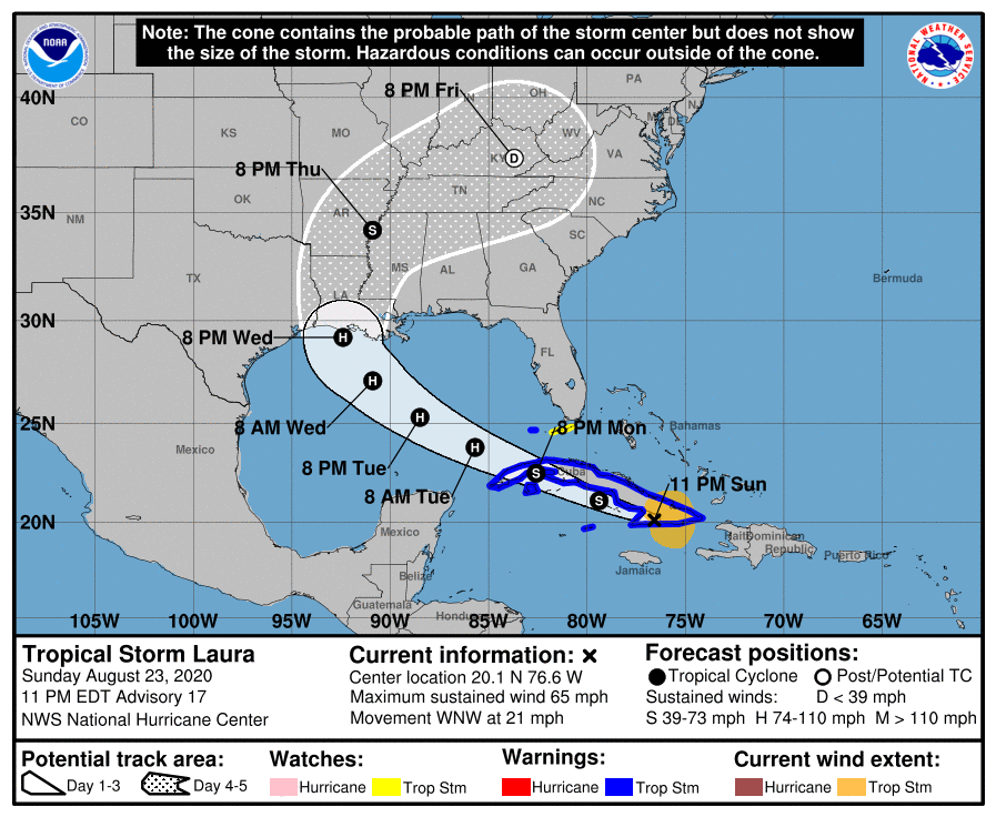
Marco is due to make landfall later this evening. Meanwhile Tropical Storm Laura, currently crossing Cuba, is forecast to strengthen as she crosses the Gulf before making landfall at hurricane strength on Wednesday night, in Louisiana once again:

FORECAST VALID 27/0000Z 29.2N  92.4W
MAX WIND 90 KT...GUSTS 110 KT.
50 KT... 50NE 40SE 30SW 40NW.
34 KT...100NE 100SE 50SW 80NW.

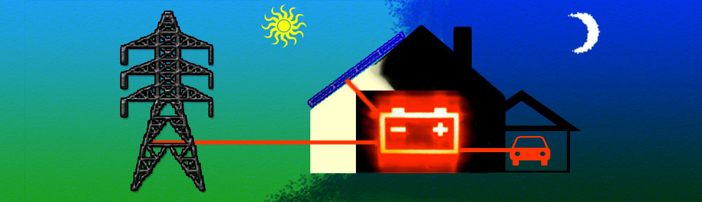
Significant damage to the electricity distribution infrastructure in the southern USA is expected. Yet again we are compelled to wonder if many of the anticipated power outages could have been prevented if areas of the United States vulnerable to hurricane damage already possed significant numbers of vehicle-to-grid capable electric vehicles and bidirectional charging stations?

Continue reading →